The United States and Great Lakes Patterns

$6.99

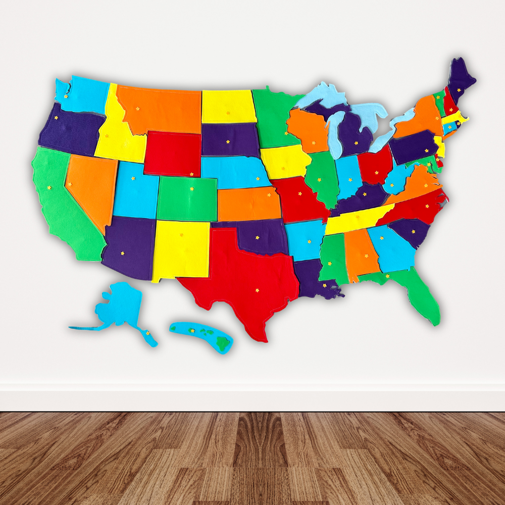
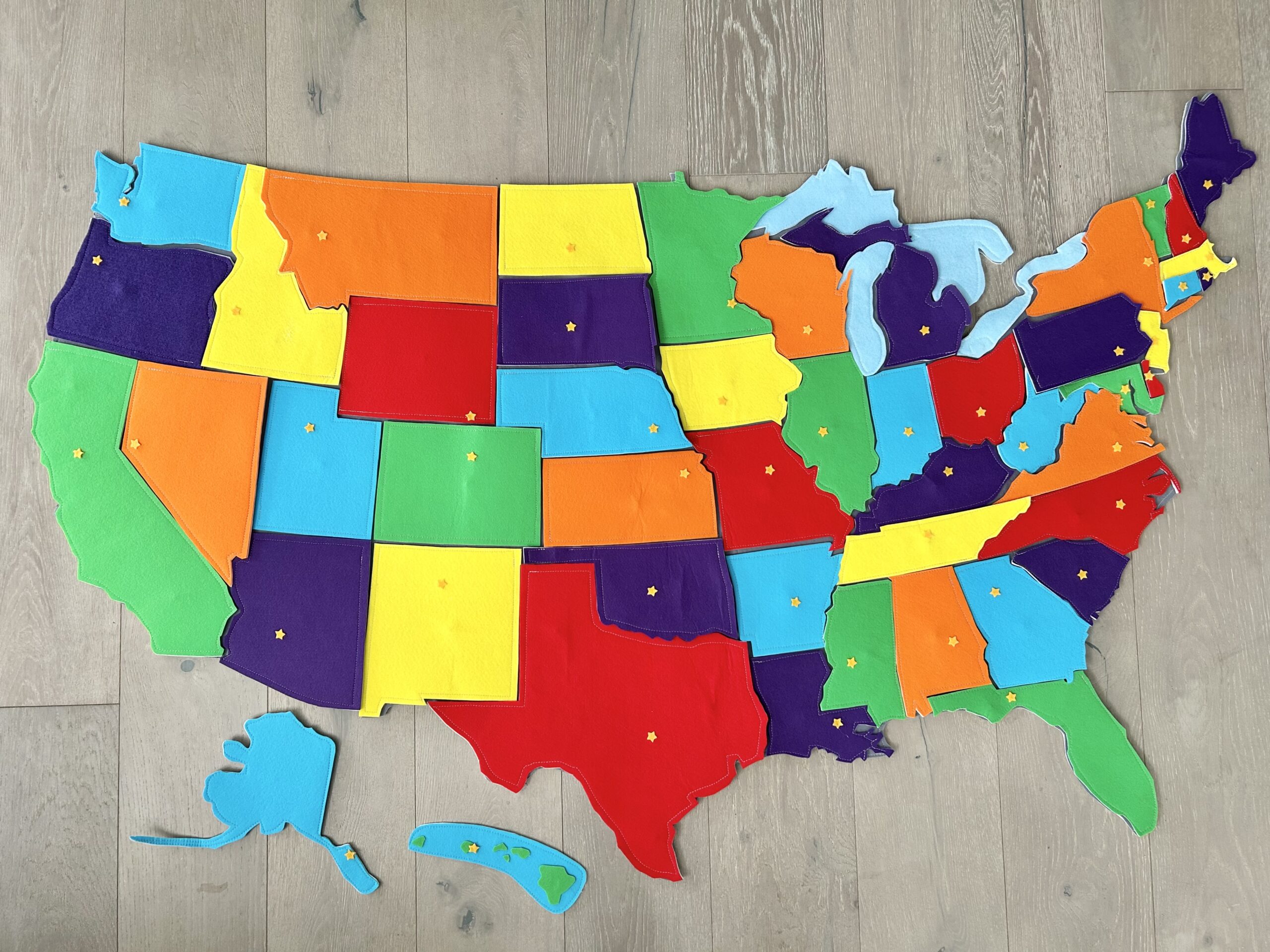
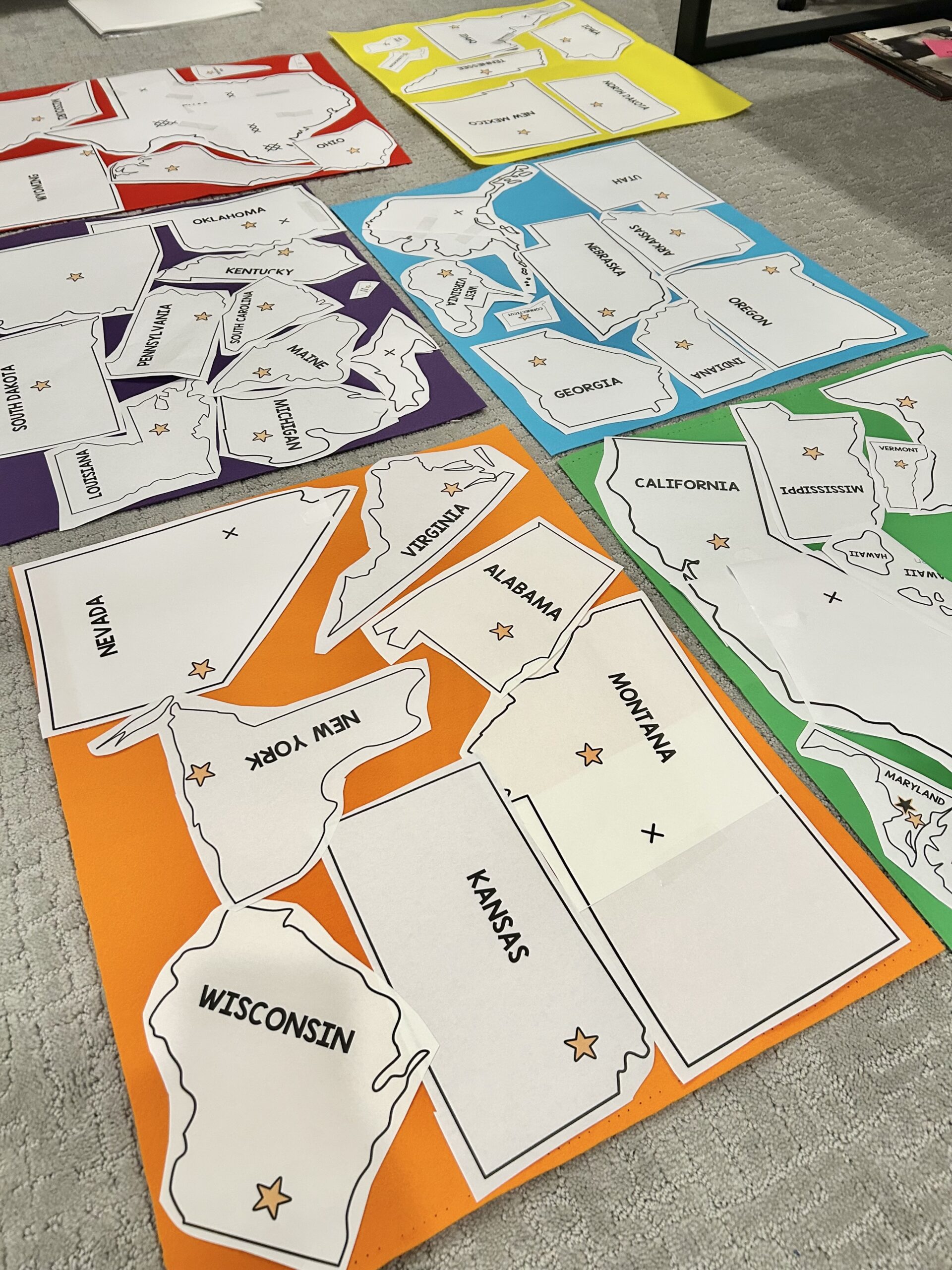
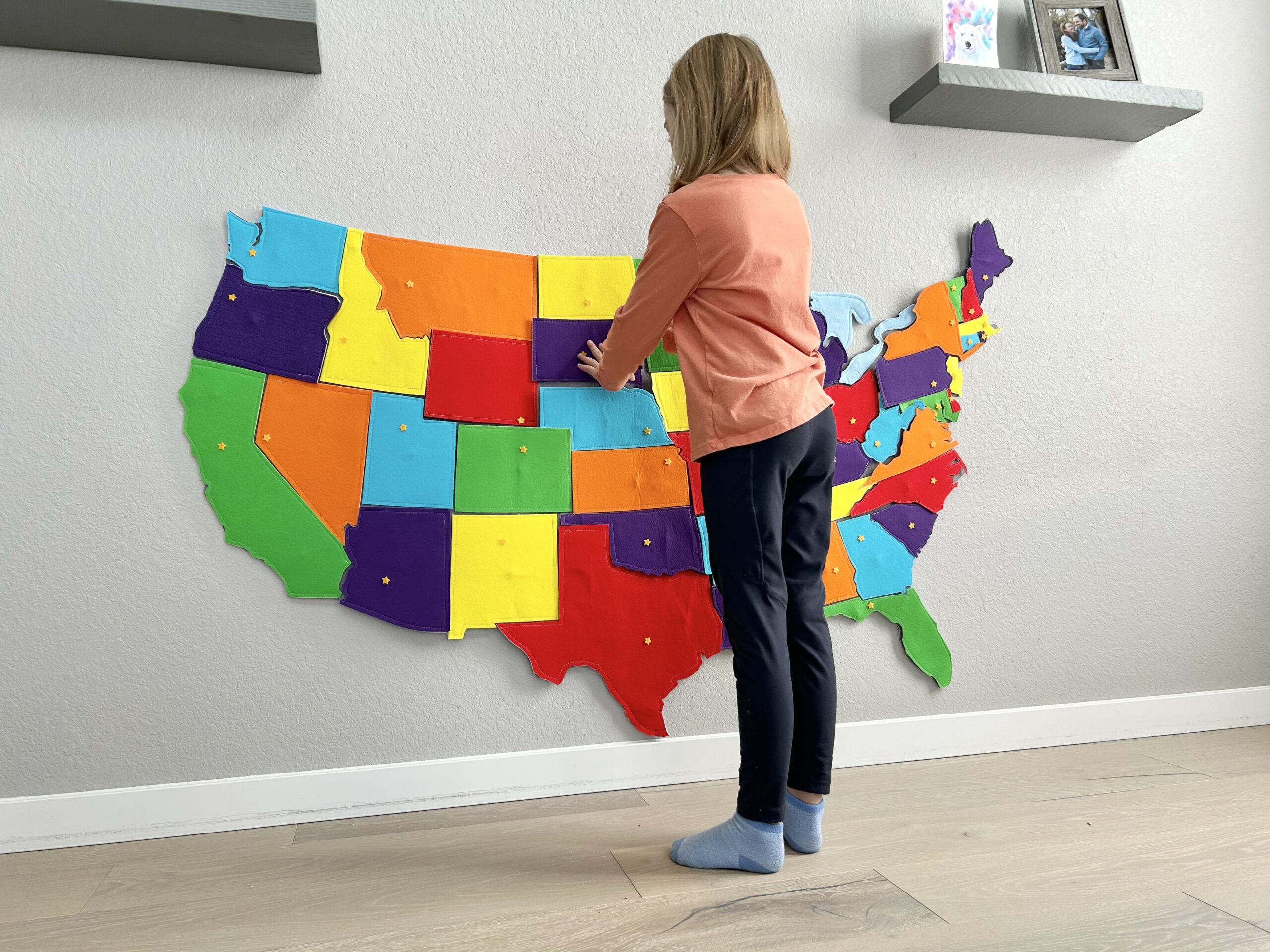
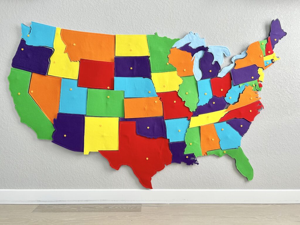
Create a hands-on, interactive felt map of the United States with these beautifully designed printable patterns. This set includes large patterns for all 50 U.S. states along with patterns for the five Great Lakes, making it a wonderful geography tool for homeschool families, Classical Conversations groups, or classroom settings.

Finished map size (approx.): 66 x 42 inches (depending on spacing and layout).

Parents can cut out each state and lake from felt and place them on a large felt background to build their own map of the United States. Children can then snap the states on and off the country background as they learn how the states fit together and explore American geography in a fun and memorable way. Capital city locations are also included on the patterns so you can optionally add small felt stars to mark each state capital.

Each pattern includes the main shape of the state. Small surrounding islands are not included in these designs. These patterns include the individual states and Great Lakes only—a pattern of the full United States map is NOT included. I recommend laying out the finished felt pieces on a large piece of felt and tracing around them to create your backdrop.

**Keep in mind, the link to download your digital file is only live for 24 hours. Be sure to download the file to your device in that time. This file is too large for a phone, please download and save to your computer.

  • Printable patterns for all 50 United States plus the five Great Lakes (a pattern of the full United States map is NOT included)
  • Capital city locations marked on each state pattern so you can optionally add felt stars
  • Clean, easy-to-cut outlines—perfect for stiffened felt or paper
  • Full tutorial explaining how to make the felt states, including recommended materials (with links)

States Included

Alabama, Alaska, Arizona, Arkansas, California, Colorado, Connecticut, Delaware, Florida, Georgia, Hawaii (plus Hawaii surrounding waters), Idaho, Illinois, Indiana, Iowa, Kansas, Kentucky, Louisiana, Maine, Maryland, Massachusetts, Michigan, Minnesota, Mississippi, Missouri, Montana, Nebraska, Nevada, New Hampshire, New Jersey, New Mexico, New York, North Carolina, North Dakota, Ohio, Oklahoma, Oregon, Pennsylvania, Rhode Island, South Carolina, South Dakota, Tennessee, Texas, Utah, Vermont, Virginia, Washington, West Virginia, Wisconsin, Wyoming

*Washington, D. C. is also labeled!

Great Lakes Included

Lake Superior, Lake Michigan, Lake Huron, Lake Erie, Lake Ontario

  • Great for visual and tactile learners—snap the states on and off for review games, map work, or memory practice
  • Durable & Reusable: When made with felt, this map holds up beautifully with daily use (even with toddlers!)
  • Perfect for Classical Conversations Cycle 3: Aligns with geography memory work for families learning about the United States this year
  • Customizable: Use any color scheme you like to match your homeschool space

How to Use It:

  • Print the patterns onto quilters freezer paper
  • Use freezer paper pattern as a guide to roughly cut out felt
  • Attach magnetic snap to felt
  • Iron the pattern onto felt
  • Cut out each state along the pattern outline
  • Mount the country on a large backing for a display-worthy wall map
  • Use it during morning time, memory review, or as a quiet activity

Frequently Asked Questions

You can use magnetic snaps, velcro, or magnets—whichever works best for your setup. The instructions include tips for how to attach them securely and make them reusable.

This is a digital download of patterns for creating large felt cutouts of the United States and the Great Lakes. It’s designed to help children learn U.S. geography in a fun, hands-on way! 🇺🇸

You’ll receive PDF pattern templates for each U.S. state and the five Great Lakes, along with simple instructions for cutting them out of felt and suggested materials for making them interactive (such as adding snaps or Velcro).

No, this is a digital product. You’ll receive printable templates and instructions to make your own felt map at home.

The patterns are formatted for standard US Letter size (8.5 × 11). You can print them at home using quilter’s freezer paper or regular printer paper.

They are sized to be large enough for little hands—perfect for a felt board or wall map setup. Sizes vary by state shape but are proportional for visual learning.

Regular craft felt from a fabric or craft store works great. For extra durability, consider using a thicker felt or wool blend. I personally like using hard Korean felt and fusible felt for durability. The instructions included in this product provide specific links for suggested materials.

You can use magnetic snaps, velcro, or magnets—whichever works best for your setup. The instructions include tips for how to attach them securely and make them reusable.

Yes! This pairs beautifully with the Cycle 3 geography memory work focused on the United States, though it’s also a great resource for any geography study.

Yes, a simple map reference is included to help guide you (and your kids!) in placing the states on your felt board or wall.

What our customers are saying

You may also like…


My United States Workbook – Digital Download

$19.99

Cycle 3 Geography Passport – Digital Download

$9.99
large felt european countries wall map

European Countries PATTERNS – Digital Download

$6.99

African Countries PATTERNS – Digital Download

$6.99